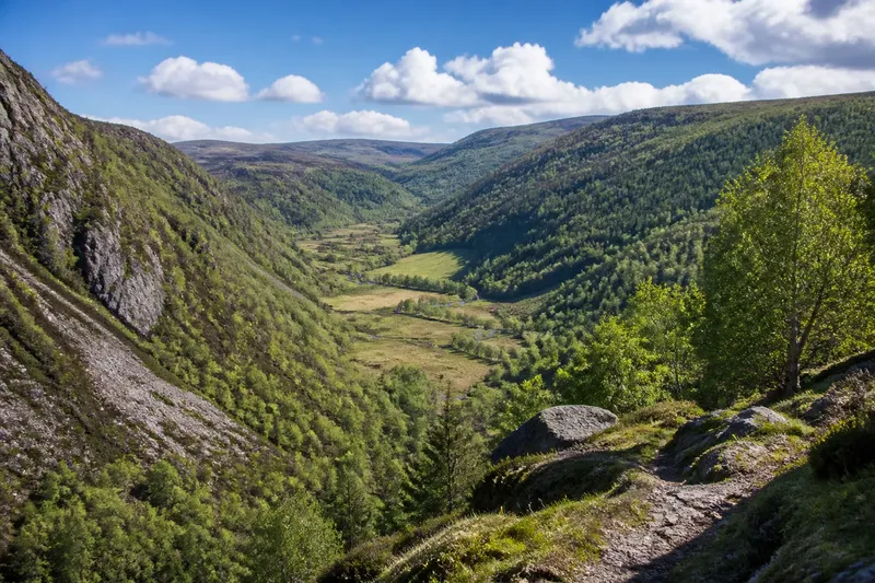
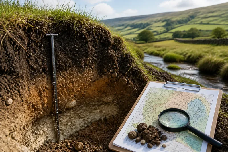
The River Is Not a Line Drawn in Place
Learn how to read a river’s changing channel and wet margins, avoid common mapping and walking errors, and make sense of water beyond the visible bank.
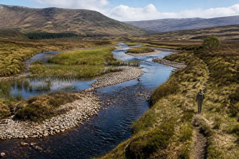
The most common mistake when reading a river is to treat the blue line on a map as the whole river. That shortcut can lead you to misread a damp hollow as unrelated ground, mistake a temporary channel for a permanent one, or plan a walk through land that becomes wet after rain. A river is better understood as a moving channel within a broader corridor of water, sediment and saturated ground.
In northern landscapes, that corridor may include a clearly defined channel, gravel bars, shallow side channels, marshy margins and low ground that floods only at certain times. The visible water offers one view of the river, not a fixed boundary around it. When a map, a walk and the land itself seem to disagree, look for the conditions that explain the difference.
Why does the river on the map not match the river on the ground?
A map has to simplify. Its river line usually marks the main channel as represented by the mapmaker, at a particular scale and from information gathered at a particular time. It cannot show every shallow thread of water, every wet patch or each shift in the channel after a flood.
The ground is also changing. A river carries sediment downstream and deposits some of it where the current slows. Gravel or sand can build into bars; water may divide around them, then rejoin. During high flow, water can spread across a low bank or use a side channel that appears dry in calmer weather. A map may show a simplified, stable-looking route while the river is behaving as a variable system.
Try comparing the map with visible landforms rather than treating either as wrong. Look for low, flat ground beside the channel, curved bands of sediment, damp hollows and vegetation that differs from the drier slope nearby. These clues can suggest where water spreads or has flowed, even when no water is present at the moment.
What should you check when a channel seems to disappear?
A channel may become hard to see where water spreads thinly through reeds, boggy ground or a broad, shallow section. It may also pass beneath a road or through a culvert, or divide into small channels that are difficult to distinguish from wet ground. In wooded places, branches, leaf litter and dense vegetation can hide the water’s edge.
First, check whether the channel’s direction continues beyond the point where it disappears. A slight fall in the land, a narrow line of darker soil or a corridor of moisture-loving plants can help you trace it. Then look farther ahead for water reappearing at a bridge, a gap in vegetation or a clearer bend. Do not assume that a dry-looking patch is a safe crossing: saturated peat or fine alluvial soil can remain soft when the surface appears firm.
If you are walking, stay on a marked path where possible and avoid stepping into a channel or wet margin to confirm its course. Where access or route conditions are uncertain, choose a safer route rather than testing the ground. Water levels and local access rules can change; follow signs and current local guidance.
Why is the ground beside the bank wet when the river is low?
A low river does not mean that all nearby ground has dried out. Water can remain in shallow depressions after a flood, seep out of a slope, or collect where the land is nearly level. In peat and other water-retaining soils, moisture may persist well beyond the visible edge of the channel.
Read the wet ground as part of the river’s setting, not necessarily as evidence that the main channel has moved. Reeds, sedges and other plants adapted to damp conditions can mark a persistently wet margin. A band of mud or flattened vegetation may indicate recent inundation, while a broad hollow with no obvious channel may hold rainwater or receive seepage from higher ground.
Imagine you reach a grassy flat beside a small northern stream and find a patch of reeds several paces from the visible bank. The stream is low, but the ground between the reeds and water looks dark and soft. Rather than treating the reeds as a second river or walking straight across, you could follow the firmer path and look for a clear, established crossing. The observable result is a route that avoids the saturated hollow without requiring you to decide exactly when or how the water reached it.
What makes a river shift its visible channel?
Channel movement depends on the material beneath and beside the water, the shape of the valley floor and the force of flow. In loose gravel or sand, the current may rearrange bars and redirect shallow threads. Where banks are more resistant, the main channel may remain more clearly confined, though water can still rise over them or enter low ground nearby.
Bends can also change unevenly: water tends to erode some bank sections while depositing sediment elsewhere. A bend may gradually alter, while a flood can make water use a side route or cut across a low area. These processes do not mean every bend is about to move dramatically. They do explain why a river should not be treated as a permanent line, particularly across broad, low-lying terrain.
When comparing two maps or observations, note the season, recent weather and the level of detail each source can show. A difference may reflect temporary flow or mapping scale rather than a lasting change in the channel.
How do you tell a channel from a wet hollow?
A channel usually has a continuous course, even if it is shallow or partly dry. Look for a defined bed, a direction of flow, exposed gravel or sediment shaped by moving water, and a connection to a stream upstream or downstream. A wet hollow may collect water without carrying it onward; it can be rounded, irregular or separated from the main channel by a slightly raised strip of ground.
One clue alone is not decisive. A former channel can hold still water, while a small active stream may be hidden by vegetation. Use several observations together: how the land slopes, whether water connects along a route, what the channel bed looks like and whether the feature appears on a detailed map. Avoid naming a hollow as an abandoned channel unless the landform gives you enough evidence.
Which river-reading questions come up most often?
Does a river map show every channel?
Usually not: a map may simplify braided water, narrow side channels and seasonal flow into one line. Use it as a guide to the main route, then read the surrounding ground and current signs.
Can a dry channel still belong to a river?
Yes. A side channel or shallow course may carry water only at higher flows, or retain evidence of recent flow after the water recedes. Its connection to the main channel and the shape of its bed help distinguish it from an unrelated hollow.
Is wet ground beside a river part of the river corridor?
It can be, especially where low ground floods, receives seepage or stays saturated in wet soils. The wet margin may not carry flowing water at the time you visit, but it can still reflect the river’s influence.
Should you cross a channel that looks shallow?
Do not judge a crossing by appearance alone: depth, current, unstable sediment and soft banks can be hard to assess. Use a recognised bridge or crossing, or choose another route if conditions are unclear.
What is not worth the effort?
There is little value in trying to trace every damp patch to a single source or deciding that every change in a map marks a permanent channel shift. A quick, careful reading is more useful: identify the main channel, note low and wet ground, check for a visible connection, and leave uncertain terrain undisturbed.
The practical habit is to read the river and its margins together. When you see the river as a changing corridor rather than a line drawn in place, the map becomes a useful starting point, wet ground becomes a meaningful clue, and a dry-looking stretch no longer tells the whole story.